 The day started for me at five in the morning. However, the hike didn't begin until 9:30. It takes awhile to pick everyone up, drive to Idyllwild, get a day hike permit, use the bathrooms, drive five more miles an a paved road followed my 7.5 miles on a dirt road. Even though we were all tired from waking up so early, the trip on the dirt road was an "E" ticket, for you younger folks who remember the classic Disneyland passes. Darin drove aggressively along the rough road, flying over the bumps at lightspeed. We arrived at the trail head for the Fuller Ridge hike up Mt. San Jacinto.
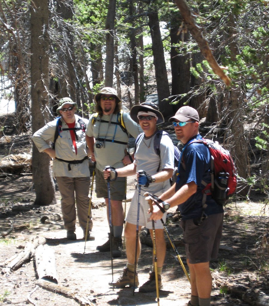 Once we got all our equipment on, we headed up the trail. The first stretch takes you up the side of the mountain to a pass, where you drop down about 300 feet in elevation. The hike starts around 7200 feet and ends at 10,834. In between there are three areas where you hike down just to hike up. The hiking down might seem nice, but then you remember you have to hike back up on the way back.
The initial pace for us was probably a little fast. I got tired quickly, not being acclimated since we just arrived from sea level. I needed to stop often, drink lots of water, and needed a meal break within the first hour of hiking. In fact, that became a problem. Everyone, that would be five of us, needed to take a break at different times due to hunger, blisters and exhaustion. That is one reason it took us six hours to travel the 7.5 miles to the peak.
After a few more trails that went up and down, and a nice lunch break near a creek, we joined the "main" trail. This is the trail that people hiking up from Idyllwild use. The hike from here is all elevation gain. By this time I was beginning to get acclimated, feeling better that I had felt before. We slowly made our way up. At one point we encountered two hikers that were resting. I heard one of them say that they were practicing for climbing Mt. Whitney. I told him that we were doing the same, and he replied by saying that last time he hiked Whitney, he hike Mt. San Jacinto every week for six weeks. He kind of implied that we weren't ready, but we never saw those two hikers again. I believe they didn't get much further.
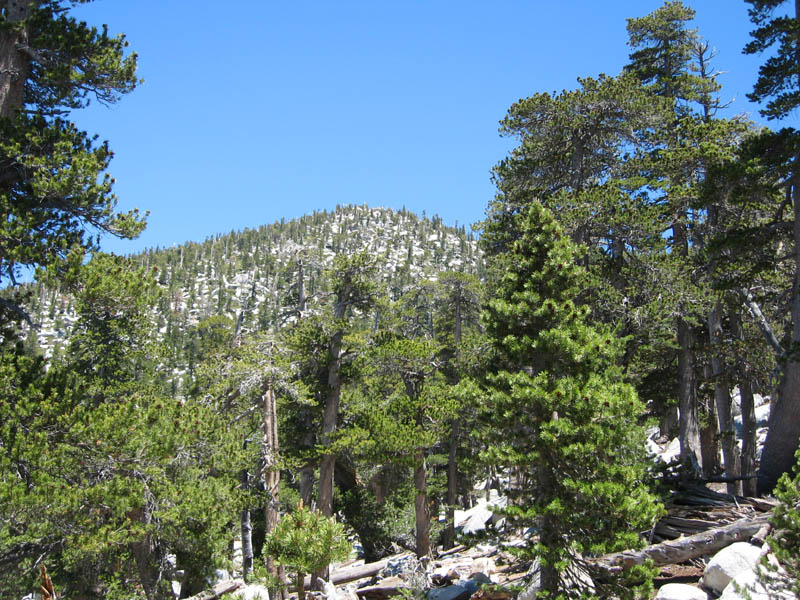
Along the way, I tried to stop to enjoy the view, but it wasn't until the hike down that I realized how breathtaking the view was. Going up I was concentrating on making it to the top - I had summit fever!
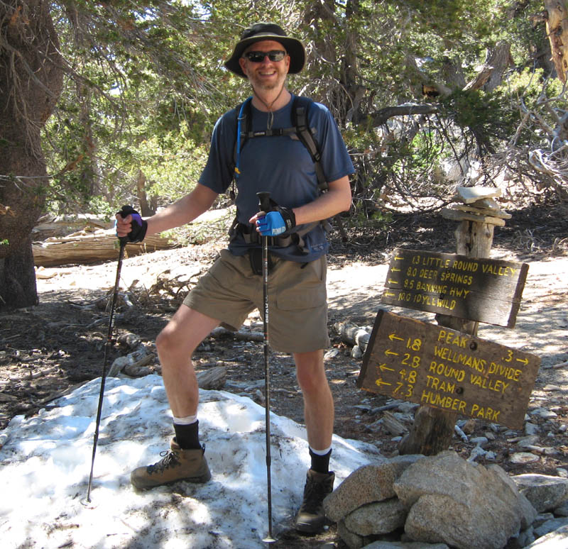
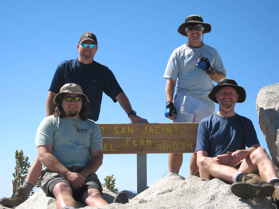
 It seemed like forever before we joined the trail that leads to the tram. From this point, it is only .3 miles to the top. However, the last stretch is a scramble up rocks with no defined path. After a short top a the hut, we made the final accent to the peak. Yes, we made it! Time for pictures, water, food and a look around at the desert far below.
I'd say were were up there for 30 minutes before heading down. We looked at our watches and realized that we needed to hurry if we were going to get back to the car by sunset.
Hiking down takes less energy, so we stopped less. However, hiking down is also very hard on the knees. All the Glucosimine, Motrin and aspirin in the world could not have stopped the pain in my knees. By the time I got near the trailhead, which was after sunset, I was walking about one mile per hour, dragging my left leg along. However, that wasn't the worst part of the hike down. The worst thing that could have happened - I ran out of water! I thought I had enough. Four liters plus a bottle of Gaterade. I drank all my water about an hour after summiting. Luckily, others had extra and let me drink some of their water. But by the end, almost everyone was out of water. We didn't bring water filters. Thank Jim for leaving two bottles in the car waiting for us. That was a lifesaver.
Like I said before, those downhills on the way up were torcher on the way back. My legs were burning with pain going uphill, and my knees were aching on the downhills. That last stretch down the side seemed to take forever. It was getting dark, I was bringing up the rear, I was out of water and it was also getting colder. I did have a sweatshirt and a light, but luckily did need either.
Once back to the truck, at about 8 PM, we headed home. That bumpy road was not much fun this time.
 Darin drove slower, which also made the drive out seem longer, which it was. Back in the local town, all the stores were closed, so we didn't stop for food until Hemit. I ordered a Six Dollar Western Bacon Cheseburger at Carl's Jr. and gobbled it down, as well as several lemonaids.
I didn't arrive home until midnight. After a nice warm shower, I went to bed and slept like a rock. I had told people at work to expect me in late on Monday, so I woke up at 8 and got to work at 9. I didn't feel as bad as I thought I would. My knees didn't hurt and my muscles were a little sore. After many cups of coffee, I was ready for the day.
Looking back, the hike was memorable and fun. One or two more local hikes this weekend and I'll be ready for Whitney in two weeks. I am excited!

2 comments:
Looks like it was a good day for the hike. Try out your water filter on the next hike.
Nice photos and what a nice landscape to hike to. Wish I were there.
Post a Comment