Sunday, October 16, 2011
Blog Action Day - Healthy Foods
Today is Blog Action Day 2011, and the topic is food. I suppose we should write about how lucky we are to have three meals a day while people all over the world are starving, but instead I'm writing a short post about my eating habits and how they can be improved. First off I have to say that I love eating and I'm always hungry. I'm also lucky enough to have a high metabolism, at least I'm told I do, so I don't gain wait. I also exercise regularly and try to eat healthy. However, I'm also very lazy when it comes to preparing my meals. I don't like to spend a lot of time. Therefor, I tend to eat pre-made, frozen meals with lots of unknown ingredients, sandwiches with processed lunch meat, and overall lots of carbohydrates. I try to eat more fruits and vegetables, but once again I'm lazy and only eat easy-to-eat fruit like bananas, which I'm getting tired of, and no matter how hard I try, I just don't like broccoli and other nutritious vegetables unless they are covered in cheese or some other kind of sauce. Plus I read more about people dying from eating contaminated fruits than meats or grains. I plan to live a long time, and I don't want a fruit or vegetable to be the cause of my death. So, in conclusion of this rambling post, I will try to eat less processed foods, breads and carbohydrates and more basic foods like fish, chicken and maybe even some leafy, green vegetables.

Tuesday, July 05, 2011
San Gorgonio Summit Hike

I'm happy to say that I have stood on the peak of San Gorgonio Mountain. I've wanted to summit this mountain for over 15 years. It was about 15 years ago that I got into more serious hiking, and somehow I never had the opportunity to hike San Gorgonio until last year, when my friends and I attempted a summit via the Vivian Creek trail - and didn't quite make it. Even though we were totally exhausted after the hike last year, I knew I wanted to try to summit again. I'm not going to let a mountain get the better of me. So earlier this year I started planning another hike up San Gorgonio. I wanted the same crew, more or less, as last year to hike with me. So over the past few months we started practice hikes in the local San Diego mountains, mostly Iron Mountain, Mt. Woodson and one trip up Cuyamaca Peak. Well, as time passed my hiking partners started dropping out, for various reasons beyond their control. So it came down to just Lee and I.

My day hiking permit was for July 1st. Because I wanted to get an early start and not have to wake up too early, I got a hotel room in Redlands, the closest city with decent hotels, for the night before. So after work Lee and I drove up, checked into the hotel, had dinner and then it was bed time. The alarm went off nice and early at 5:30 AM. My original plan was to start hiking by 7 AM, but somewhere along the way I was convinced by one of my friends who ended up not going (sorry, Dan), that a 6 AM start was better. No matter how hard you try, everything takes longer in the morning than you expect. By the time we ate and left the hotel, we didn't get to the trail head until almost 8 AM.
When we pulled into the parking lot at Forest Falls, we were immediately attacked by swarms of bugs including blood-sucking mosquitoes. I didn't bother bringing any bug spray, because it never seems to work. So once we got all our hiking gear on, we set off. Even though it was later than I had hoped for, we still were starting about two hours earlier than the year before, when we drove up from San Diego the morning of the hike. The beginning of the hike was easier, because it wasn't detoured through the river bed like last year. We got to take the regular dirt trail, making the trip to the beginning of the Vivian Creek trail much easier and quicker. However, unlike last year, no big horn sheep sightings. In fact, we saw very little wildlife on the whole trip. Other than some chipmunks and birds, the sighting of a quail and her offspring was the only wildlife viewing highlight of the hike.
 Since we had just done most of this hike the year before, we concentrated on getting to the summit, and not spending much time stopping to take pictures. We did make sure to stop every 60 to 90 minutes to eat some food and rest. The very beginning of the trail, as some of you may know, is VERY steep. However, this year I was mentally prepared. We actually made it up this section stopping only once, and that was to talk to a man that had already lost track of this wife and friend. He said his friend was behind him and his wife was ahead of him. We told him if we saw either of them we'd let them know that he was waiting for him.

Continuing on the hike, we were passed by two very fast hikers who were very nice. We talked briefly, and as hiking goes, we later passed them as they rested and then later they passed us. As we approached High Creek, at about noon, we stopped for a break and since this was the last source of water, we used my water filter to refill our water for the final trek to the summit. Also, we ran into the "friend". She too was wearing head netting. And, like her hiking partners, was confused as to their location. She thought that they were both ahead of her, and we told her that they were behind her. She told us that they, plus two others, had permits to hike the John Muir trial in September, a three week trip. That sounded great, but they better work on their hiking-together skills. Lee was very nice and offered to filter water for her, and she accepted. Once we left the creek we wished her good luck, and that was the last we saw of her or her friends.

So this was the section of the trail that last year someone we met on the trail told us that it was 15 minutes up these switchbacks and then 45 minutes to the summit. Last year it took one hour to reach the "saddle" at the top of the switchbacks, and this year it took the same amount of time. The saddle is the spot last year where Lee and our friend Jim stopped, and the rest of us kept going. We took a break here, had some food (a very sweet and moist brownie for me), re-tied our boot laces, and then set out for the summit. It was about 1 PM, and my goal to reach the summit by 2 PM seemed optimistic.
Before long, the trail got really steep, and soon, like last year, we were stopping every few minutes to catch our breath. I had forgotten how difficult this section was. Eventually we reached the plateau that last year had the most snow. This year, even though there was record snowfall in these mountains, there was actually much less snow. In fact, we didn't have to hike through any snow at all. Also, the creeks seemed to be running lower. It was hot, so the snow must have melted quicker than last year, even though we were hiking about two weeks later than last year.

Soon we reached a trail junction. From here it was only .6 miles to the summit. We also met another hiker who had lost her friend. She was looking for a "fair-skinned" woman with a head bandanna. We told her we had seen no other women on the trail. So she shouted her friend's name (Crystal), after after the echo, she heard her friend respond. So she took off to the summit, leaving us slow, old men behind.
However, it wasn't long before we came to a crest, and for the first time the summit was in sight. We saw three people on the summit, which is basically a big pile of rocks. Within a few minutes were at the summit of San Gorgonio! Time to celebrate and take photos to prove that we were there. We arrived about 3:15, so that's about 7 hours of hiking, covering 8 miles. Just over 1 MPH average. That seems slow, but we did stop about 10 to 12 times along the way.

At the creek, we filtered water, and I also put on a fresh pair of dry socks, applying new blister pads on two of my toes. After the stop we made good progress down the mountain, but now my knees were starting to hurt me, despite having the hiking poles. I knew the steep section at the end would be painful, but I'd deal with that later. I didn't want the rest of the trip to be un-fun, so I made a point to stop along the way and take some "funny" photos, which didn't turn out all that funny. I had Lee take a photo of me "stuck" trying to cross a fallen tree, but the photo didn't capture my facial expression very good, making it look like I was doing something "obscene" with the log. Oh well. Speaking of fallen trees, there seemed to be less this year, implying that some had been cleared since last year. There was only one tree that was semi-difficult to get around. On the way up I went under it, but on the way back I went over it which was much easier.

Even though the sun had set, there was enough light to see the trail. We crossed Mill Creek, I believe it is called, and then got to the dirt trail/road back to the car. Since we were tired, the trial seemed much longer than it did 12 hours earlier. Just like last year, we got back to the car with just enough daylight to see without using our head lamps, as there are not lights in the parking lot. After a quick change of shoes (man, it felt good to get those boots off) we got in the car and headed back into town for dinner. The night before after leaving Red Robin, I saw what looked like a sign for Five Guys Burgers and Fries. So that was our goal. As we got closer to the freeway, I thought I made a wrong turn, but by dumb luck, we ended up driving directly to the restaurant.
Neither of us had eaten here before, so this was new adventure. We both got the bacon cheese burger, and we shared the fries on the advice of the cashier who said they fries will server two people. I must have been hungry because I devoured the burger and fries in a mater of minutes. As it was approaching 10 PM, we left and headed home. The drive went by pretty quick, but we didn't get to my house until 11:30, and Lee still and to dive even further to get to his home. Just like any other long trip, I can't just get home and go to bed. I had to shower to remove the layers of dirt, sweat and sunscreen. Then I unpacked, checked my e-mail, and as promised, by me, I drank a cold beer in celebration of my accomplishment. I finally went to bed at 1 AM on Sunday, making it a 20 hour day.

Will I hike San Gorgonio again? Well, as of now, I'm not planning on it, but who knows how I'll feel next year. If I do hike it again, I'm going to be a follower, not a leader. I'm more than happy to let someone else plan and organize the hike.
Sunday, June 12, 2011
Cuyamaca Peak Hike

I've wanted to hike Cuyamaca Peak, which is located in Cuyamaca Rancho State Park and the Cleveland National Forest, for many years. My friends and I are training for a hike up San Gorgonio on July 1st, and I thought Cuyamaca Peak would be a great training hike as well as an enjoyable day hike. Out of the five people who are planning to hike Gorgonio, only my friend Dan and I made this hike.
Looking at various maps and web sites, I saw that the easiest route up the mountain was the Lookout Fire Road from Paso Picacho campground. The round tip is about six miles (every site lists different distances, from 2.5 to 3.5 miles one way) but I wanted to extend the hike a little longer. So I found a route from LocalHikes which sounded interesting.

We arrived at the Paso Picahco campground around 9 AM and began hike by 9:15. We purchased a map of the park when we paid our $8 day use permit. Looking at this map, and comparing it to the one I had printed the day before, I noticed that the trail names from one map weren't on the other. So we decided just to start hiking on what seemed like the correct trail. The goal was to take Azalea Glen Trail to the Conejos Trail, which then connected to the Lookout Fire Road. The beginning of the hike was on a narrow trail with very tall vegetation on both sides. This made for a nice, cool hike, but when we caught up to a large group of slow hikers (mostly children), it took a little maneuvering to pass them.
Still not knowing the exact route to take, each time we came to a trail junction I'd take out the map to see where we were. Many of the trails we saw weren't on the map, so when in doubt we just kept on the same trail. I was pretty sure that the rail would intersect with Azalea Springs Fire Road. Along the way we talked to another group and they also weren't sure if they were on the right trail. They were just doing the "loop", but the hike was taking longer than they thought and their kids were getting tired. We both looked at the map, and using my cool new Casio Pathfinder watch, which has an altimeter, I saw we were at about 5100 feet elevation, so following the contour lines on the map I estimated our location, determined we were on the correct path, and continued to hike on.

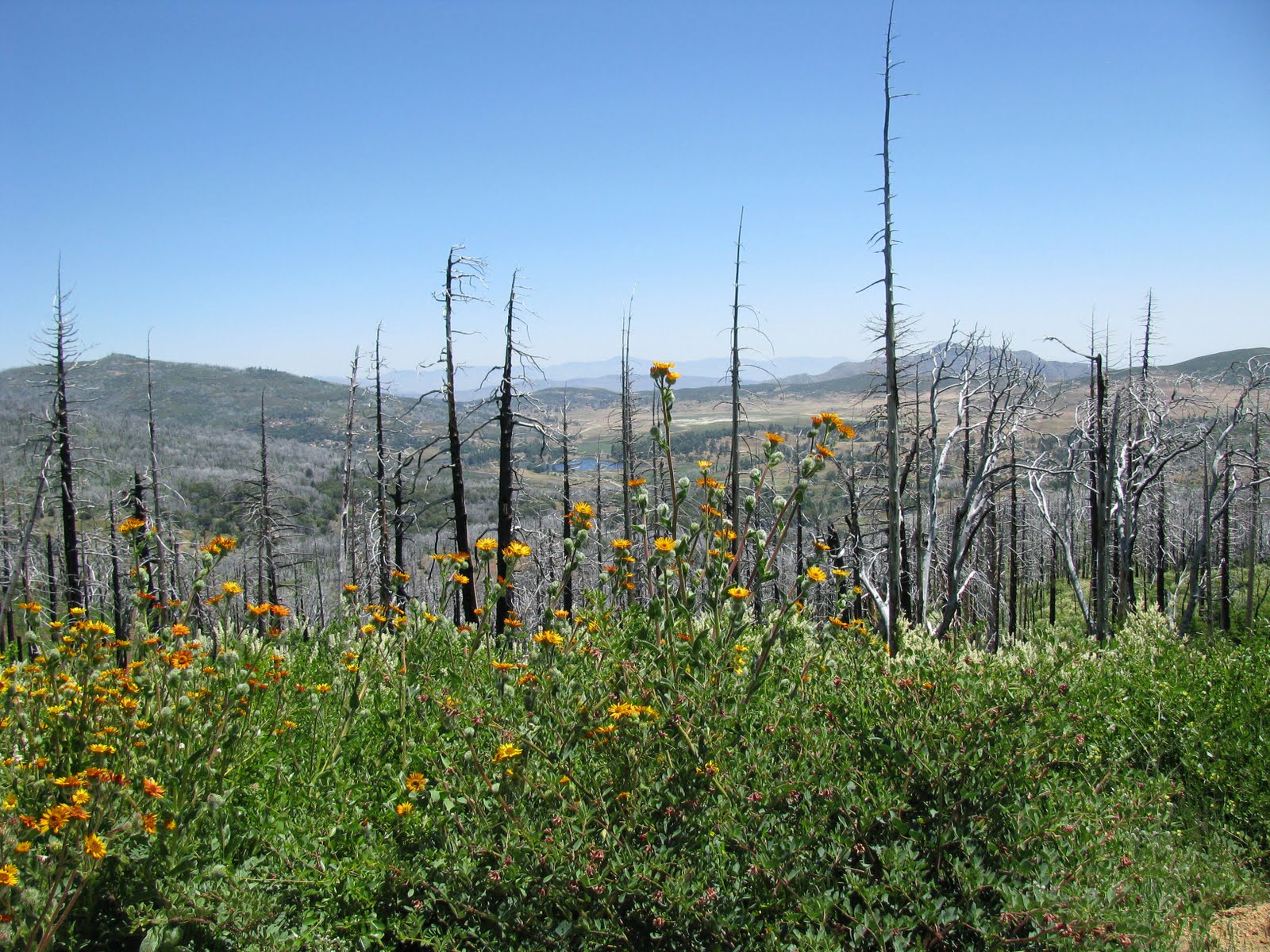
At the beginning of the trail there was evidence that the trail had been recently closed, and we saw many trees that had fallen down across the trial had been recently cut, plus we could hear chain saws in the distance. The entire Cuyamaca park was almost completely devastated by the Cedar fire in 2003. You could see that almost all the tall trees were burnt, and all the new growth was smaller trees and bushes.
After hiking for about an hour, we made it to the fire road. From here, the trail was marked with signs and white chalk indicating which direction to go. The trail was closed to the north, but we knew we wanted to keep going southwest. Then we came across another trail junction. Looking at my map, it looked as if we should have kept going straight, but that trail looked closed, so we followed the white chalk arrows again, which led to a very muddy tail. Wearing good hiking boots prevented my feet from getting wet, but there was girl with the other group wearing sandals, and she wasn't very happy to be hiking through the mud.
Eventually we made it to the Lookout Fire Road. However, we never saw the Conejos trail I wanted to take. Unfortunately, the fire road was just that, a paved road. Not much fun for hiking, as the pavement is harder than dirt, and not very scenic. As we continued to hike, I saw a peak nearby, and wondered if that was Cuyamaca Peak. So I took out my cell phone and launched an application called BackCountry Navigator. I had installed the application the day before and downloaded a topographical map of the area onto my phone. The program allows you to use your phone's GPS to track your route using the maps offline (without a cell signal). Since I had never used this app before, I wasn't sure how to determine direction, so I didn't know where that peak was in relation to our position. I was a little concerned we were on the wrong path, especially since we couldn't see any other peak. I quickly gave up, turned off the phone, put the map away and proceeded up the road. (I located that peak on-line when I got home and found it was Stonewall Peak, which is actually on the east side of highway 79.)

When we finally saw other people hiking down the road, we figured we were going the right way. Then we could see the peak, or at least some towers and antennas. The road was quite steep, as it was designed for vehicles and not people. As we got higher the views got better, but I knew the best views would be from the top, where you could see 360 degrees and 100 miles on a clear day, and today was very clear, as least in the mountains. It was in the mid 70s, with a slight breeze. Perfect hiking weather.
The peak that at first looked really far away quickly got closer, and before we knew it, we were at the top! Well, actually I went ahead of Dan and reached what I thought was the peak, but after about five minutes of waiting for Dan, I realized that the trail just before the peak must have been the correct trail to take, and sure enough it was. So Dan reached the summit before me, not that we were in any kind of race.

There were only a few other people on the summit, including a couple that passed us along the way, and we overheard the woman saying something like "She's going through a divorce, so she probably has a gun.". Hmm - let's avoid them. Except they were the only ones at the top available to take a group photo of Dan and I, and there were both very nice.
From the summit, the views were amazing. Looking west, you couldn't quite see the Pacific Ocean because it was covered in June Gloom. Off to the North you could see many mountains, some covered with snow. Using a web site when I got home, it showed that San Jacinto and San Gorgonio were visible. Kind of cool that we could see the mountain we were going to be hiking the three weeks from so far away. Off to the east the mountains of the Anza-Borrego desert were visible, and finally looking south towards Mexico, there was lots of haze in the air, limiting the view making it the least picturesque direction.
After taking my fill of photos, and the standard 30 second, narrated movie, we headed down. When I hike, I'm usually oblivious to my surroundings. I tend to concentrate on the hike, taking time to look up and notice the scenery in the distance and not noticing what's just along the trial. My friend Dan tends to notice everything, such as flowers, plant, bugs and rattle snakes. Yes, if he hadn't said anything I might have stepped on the rattle snake laying in the middle of the road. It was about 10 feet away and just laying there, not coiled up. But as we stepped closer, he began to slither away, shaking his rattle to warn us, but quickly disappearing in to the brush. The snake was the biggest wildlife we saw. No dear, mountain lions (which is good) and not even a rabbit.
Once the snake was gone we continued hiking down. Up to this point I hadn't experience much pain in my muscles, knees or feet. But I could feel one toe starting to burn, like I was getting a blister. So we stopped so I could put on a blister pad. It made a big difference and my foot felt better, but just a few minutes later we came around a corner and there was the camp ground. I had to laugh at myself. If I had waited just two minutes I would not have needed to stop to put on the pad. The hike down was much quicker and neither of us knew how close to the camp we were.Also, we were hiking so fast we never even saw the trail we took to get to the fire road. Oh yeah, on the way up I finally did see the Conejos trail, but who knows what path we should have taken to get there. I read online that the trail was actually a "hodge-podge" of trails, which kind of makes since.

Back at the car, I looked at my watch and it was 2 PM. So we hiked for about 5 hours. I still not sure how far, but I estimated it was less than 8 miles. Still, a very good training hike. I must say, it felt good to take off my boots and put on comfortable shoes.
My plan for the day was to eat lunch on the way home and then once home, take an afternoon nap. However, since the hike took longer than expected, lunch at 3:00 became "lunner", and the nap became bed time. It was a good day, and when I woke up this morning, I still felt good and better yet my knees don't hurt and my leg muscles aren't too sore or tight. Maybe it will catch up to me tomorrow at work. Work - yuck!
Sunday, May 01, 2011
Mission Hills Bike Ride

On a beautiful Saturday morning in San Diego, I put my bike on my car's bike rack and drove to my friend's house to go for a casual bike ride with him and his girlfriend. Our plan was to ride to and explore the Mission Hills neighborhood of San Diego. I've never really spent much time in this area, but once we survived the non-bike-friendly streets of Hillcrest, mostly Washington Street, we arrived in a very nice, quaint neighborhood, with very nice houses that had plenty of curb appeal.

The styles and colors of the houses were very diverse. Some looked like small cottages, some were huge mansions, and some looked like a house you would see in Germany or some other European country. And the colors were blue, pink, yellow, green and every shade in between. Not only were the houses unique, but so were the streets. We explored many "Not a Through Street" streets and found ourselves biking down steep hills just to have to ride back up again. In these areas were houses built on steep canyons, some with views of San Diego and the Pacific Ocean.

After about an hour we decided to ride down Juan Street, the steep road that takes you in to Old Town. We got a little turned around (not lost), and I actually had to use my Android phone and Google Maps to find our way to the street. So we road down Juan Street, which is steep and narrow, but not as steep as I thought it would be. Once at the bottom we found that the roads into Old Town were closed to cars. But we could ride our bikes, and to our surprise, we found a Cinco de Mayo street fair celebration taking place. We had no idea, so this was a bonus. We just wanted some tacos.

We locked up our bikes and walked around, quickly finding a taco stand where we each bought one very delicious, and hot, taco. So after a taco you need a beer. We found that too, and drank a beer or two while watching all sorts of interesting people walk by. Then we headed back out to explore the festival. Along the way we watched a wrestling demonstration, which was very popular, based on the crowd, a lowrider car show, with lots of brightly painted, custom cars, and then some kind of equestrian event with women in bright, colorful dresses riding horses, side-saddle of course.
Knowing we had to ride back, we walked back to our bikes and headed home. I opted to ride my bike, not walk it, up Juan Street without stopping, which I did, but the two tacos and two beers sitting in my stomach made the ride more challenging. We took the most direct route back to our starting point, completing a very fun and physical bike ride.
Sunday, March 27, 2011
Spring Training 2011

I've been going to watch Spring Training baseball in the Phoenix area with my friends almost every year since '93, 1993 that is (inside joke). This year we had eight people along for the trip, six of us on the same flight from San Diego. We actually got to the airport earlier than normal, just to find the security line for Southwest about an hour long! By the time we got through security we only had time for one beer!
We arrived in Phoenix about on time, after a short flight where everyone got a free drink for St. Patrick's Day. Before checking into the hotel, we made a stop at the Tilted Kilt for some beer and food. This location was having a huge party out back, which cost $5 to enter, but for some reason, even at 10PM, the DJ was packing up his equipment. However, we got seated inside quickly and all had a nice meal.
We then checked into the hotel and got ready for our four-day adventure.

We had tickets for every day except the first day. We wanted to see (and did see) the Dodgers at San Fransisco in Scottsdale, and these tickets sell out very quick. So we had to buy them the old fashion way - from someone outside the stadium. Luckily the person who organizes the trip, Steve, is very good at buying good seats at a decent price, and he didn't let us down. Regular scalpers, and there are always tons of them, were asking $100 for lawn seats. We bought our tickets from a man who had extra tickets at face value, so for $30 a ticket the seats were pretty good.
The stadium was sold out, and they announced that there was a new attendance record, which still doesn't make since to me how you can keep having sell-outs AND break attendance records. Do they keep adding more seats?
After the game, which I really watch very little of, as usual, we jetted back to the hotel. Back when we were young, we'd go straight to the happy hour for our free drinks from 5:30 to 7:30. Now days most of us need a quick nap in between. A quick shower to wash off the sunscreen helps too.

On Saturday our game was in Peoria to see the Cubs at the Padres. Almost every year our trip coincides with the first weekend of the NCAA basketball tournament. With about 48 games played over the four days, there is always some good college basketball games to watch before and after the baseball game. But this year we had the Aztecs in the tournament, and they played Saturday at 3:40. So when we got to the park Saturday morning, we went to go watch the beginning of the UCLA game at McDuffy's across the street, just to find that it was gone, just like the one in Tempe. But luckily there was a sports bar next door that had beer, food and lots of TVs showing all the games. So we had some food, beer and even played checkers! I'm embarrassed to say that it had been so long since I had played checkers that I forgot how. But somehow I won the first game and lost the second.
As the baseball game start time approached, most of us left to go see the Padres play. We stayed through the end of the game and then returned to the bar to see the Aztecs win! Yes, the Aztecs finally won a NCAA game. Since this bar was near the Padres ballpark, there were lots of San Diego fans cheering for SDSU.
Saturday is our traditional night to get "dressed-up" and eat at a nice steakhouse. In years past, we went to a place called Fresher's. This year we tried a different place, the Stockyard. It was located in the middle of nowhere, near the airport, but was very crowded so apparently well known by the locals. Their food was good, I got the 12 oz Filet Mignon, medium well, and it was satisfying, but I guess I'm just not a big fan of steak, because I don't think the steak tastes better the more you pay for it. The highlight of the meal for me was the dessert, a root beer float with Jack Daniels. It was surprisingly good.

For Sunday we had planned a very full day. It started with waking up at 6 AM so we could get in a hike. In previous years, we had hiked Camelback mountain, alternating our hike up the east and west sides. This year we explored a new mountain, South Mountain, described at the largest urban park in the US, or something like that. I own an apology to the guys in the next room, because they wanted to hike also and due to poor planning they got left behind.
The nice part about this mountain was that is was easier to get to and there was plenty of parking. Also, the park was very large, I'd say 20 miles long and 5 miles wide. There were tons of trails, so you could spend your whole day hiking, or just hike for an hour or two. We took a trail that followed a ridge, which took us up some really steep trails. Unlike hikes in the past, it was not not. In fact, it was quite cold and in places the wind was blowing our hats off. I think we hiked for about 90 minutes before heading back to the hotel.
Our third game was at a new ballpark in Scottsdale to see the Rockies play the Angels. This park was actually on an Indian reservation, which made in convenient to go to a casino before the game. We had about an hour to lose money. I just played some video poker and slots, but wished I'd played the new roulette table. They now have automated roulette where the wheel spins automatically and you place your bets on a computer screen, taking the human and group-play element out of the game.

The new stadium is nice, like most of the new ballparks, but they need to work on better access and parking. We did get a good parking spot, and our seats were also good, as can be seen by the photo above. I believe this game was tied after 9 innings, so we left and went back to the hotel.
After the shower/nap/happy hour, we headed out to dinner, this time we went to a place we had not been to before, Four Peaks Brewing Company. They brewed their own beer, and I, of course drank the darkest Stout. For dinner I think I had a bacon cheeseburger.
After our meal, we made it too our second destination for the night - bowling! A quick shout-out to Rick, who was our designated driver for the trip. Just a few weeks before I ate at a place near home that had a bowling alley, and mentioned that it had been over 15 years since I had bowled, and I said I didn't need to ever bowl again. But even though I only scored 99 on my first game, I had tons of fun. In fact, we all had fun bowling.
After bowling, most of us went to another bar, where we stayed until 2AM, well past our bedtimes. But hey, we were on vacation, and this was our last night.

Waking up before 9AM on Monday was hard, but getting my free breakfast was important. Nothing better than a cook to order omelet. It's always nice when the cook remembers you and says see you next year. Pam has been working there for a long time, but she gave us a warning - wear a hat because the rain expected on Monday would be radioactive. OK, good advice.
It is always sad when we have to pack up and check out of the hotel. It means the fun is over. We had planned it well to have our last game in Tempe, to see the Angels play someone, at the ballpark closet to the hotel and airport. We arrived in plenty of time to hang out at the van and finish the ice cold beers, at least for those of us who could still drink after our bender of a weekend. The forecast was for cold and rain, and rainy and cold it was. The game wasn't canceled, so we went into the stadium, but since it was raining the whole time, I never even got to sit in our seast. We ended up leaving before the third inning, and drove back into town to have some food at Dave and Buster's.

After eating, and playing some games, we returned the van and checked-in at the airport. The line for security was very short, however, three of us got in the wrong line for scanning. Apparently they were training someone new, and our line moved VERY slowly. We still had plenty of time, ever more so since our flight was delayed 50 minutes. When we finally boarded the plane, after some time of sitting the pilot announce that we were waiting to be de-iced! Yes, in Phoenix. They explained that the plane had been on a long flight, and that caused the fuel to get cold, and since it was humid outside, the wing was icy. So another 20 minute of sitting. Then there was an incident that most people didn't notice, a passenger a few rows in front of us did something to cause the flight attendant to get in her face. So even after taxing away from the gate, we stopped and sat some more. Then they announce that we needed to return to a different gate to take care of a situation. Meanwhile, some man starting yelling something about voting to have that person kicked off the flight, and then another man yelled at him to stop yelling because nobody cared what he thought. When we finally reached the gate, a woman showed up (not an armed security) to escort the passenger off the plane, who was also a woman. This woman then began to yell at the flight attendant saying "why are you doing this to me? I didn't do anything wrong!". It wasn't until we finally landed in San Diego, two hours late, that we found out what happened. The woman who was kicked off kept complaining that she had a headache from the smell of exhaust fumes and had demanded that she be given oxygen. Like that was going to happen.
So we got our luggage, took the shuttle to the parking and I was home by 10:30 PM. Did I have a good time? Yes. Too good of a time. I worked for one day before getting sick and missing two days of work. Now, six days later, I'm still recovering from my cold, and yes, I can't wait until next year.
Monday, February 28, 2011
Mt. Woodson Snow Hike

Six days after my last hike up Mt. Woodson I was once again hiking up the trail to the summit. This time the snow level was supposed to be down to 2000 feet, so I was hoping to actually see some snow on the trail. Around the halfway point, I started to see some snow, or frozen hail, in shady spots along the trail. But as I got higher, there was more "snow", even where it was exposed to the sun.

There were young people hiking the mountain faster than me, and I let them pass as I took some photos. Soon, they were throwing snowballs at each other.
As I got higher, the snow was on the trail, and I actually was glad I had my hiking boots and poles. Once I hit the pavement, there was a shady spot where the ice was slippery and I had to walk slow.

Once I made it to the top, where there were pine trees with melting snow dripping on me, I once again, like last week, headed to the east side where there were great views of the snow on the mountains to the east, like Cuyamaca and Luguna. I took a short movie that covered about 270 degrees of visibility.

Even though there was lots of snow at lower elevations, I believe that the snow level was lower in 2008, as can be seen in this link taken from Iron Mountain in Feb. 2008 - by me!
As I hiked back down from the summit, I felt really good about life in general. I was relaxed and not worried about anything - just enjoying the moment. I started the day at 8:30 AM, started hiking at 10:30, and got home at 2:30 PM. The hike took more or the entire day, but it was well worth it.
Tuesday, February 22, 2011
Mt. Woodson President's Day Hike

I arrived at the parking lot at 10 AM and was surprised to find it mostly empty. Seems that the local schools didn't have the day off, so there were fewer people out than I expected. Also, it was warmer than expected. Even though it may have been "only" 60 degrees, I didn't need a jacket, just my hiking pants and short sleeve shirt.

I might have started hiking too fast, because I quickly ran out of breath (as the expression goes), but that didn't slow me down. I passed everyone on the trail. Everyone including two ladies with three dogs (not on leashes), a father, son, grandfather trio, and a man with a mustache.
I wasn't in a hurry, so I stopped as often as I needed to take photos of the surrounding snow-covered mountains, blue lakes and green valleys. I did take a break at the "shady tree" to eat a protein bar, rest and stretch my leg muscles. While there a couple passed by and asked how much further to the top. I told them about 30 minutes, which later turned out to be way off, as I encountered them on my hike down as they were still headed up. They too had a dog, so they must have taken more breaks, or got lost because I never passed them again on the way up.

Once I got to the summit, I took a short detour down the other side just far enough so I could get a good view of the mountains in the east which also had lots of snow. I then took about a ten minute break to eat, adjust my boots, check-in on Foursquare and upload a photo to Facebook. It had taken me just over 90 minutes to hike to the top, but I knew I'd get back faster as I planned to not stop on the way down, and not stop I did. Along the way I encountered almost all the people who I passed on the way up, some were still hiking up, others must have turned around before summiting. There were also lots more people, most young people, hiking up as it was now afternoon.
I got back to my car about 1 PM, so the total hike time was three hours, just as I had estimated. I was prepared this time to not get blisters by putting blister pads on my toes before hiking. I was a little sore and tired, but nothing that an afternoon nap and good night's sleep can't cure. If it is not raining this weekend, another hike would be fun, and they expect the snow level to get even lower. How cool would it be to have it snow on me at the top of Mt. Woodson?
Monday, February 14, 2011
Iron Mountain Valentine's Day Hike
I hadn't planned to take Valentine's Day off work, but due to contractual issues with the government, I was forced to take a day of vacation. So what better way to spend a day off than to climb Iron Mountain on a beautiful, clear, sunny day? I was surprised at the number of cars in the parking lot considering it was a work day. Also, for some reason, there quite a few school-aged children with their parents on the trails, so they most have taken some family time off. There was a mother hiking down with her two small kids and as the 4 year old boy saw me he said "Happy Valentine's Day and enjoy your hike." How nice! Apparently he was saying this to everyone on the trail. His mom seemed to tolerate it and his sister accused him of steeling that line from her.
Even though there were more hikers than I expected, there were a lot less than my last hike up. And to avoid the horrible blister I got on that hike five weeks ago (that are still healing), I put blister pads on before hiking. I didn't plan to hike very fast, but somehow made it up in 55 minutes.
Along the way I saw a poor women being helped down by two people. She twisted and sprained her ankle and was making very slow progress. In fact, I passed her on the way down, about 45 minutes later, and she had only made it maybe 1/8 of a mile! At that rate she'll be lucky to get down by sunset. Hope she is OK.
Once I made it to the top I saw how crowded it was. There must have been 20 or more people, including a large group of what sounded like British citizens. After stretching, eating a snack and taking these photos, I headed down. My timing was bad because I left a few minutes after the large group of hikers left. So I had to pass them all on the way down, trying not to run them off the trail (they were all in their 50s or 60s).
Speaking of trails, I noticed that the trail had been improved since my last hike. Many of rain-induced ruts were filled in with fresh dirt, making the trail much safer. As I neared the new trail junction, I saw about 15 people in bright red coveralls hiking up. I assumed they were headed up to do more trail improvements. And back at the new trail junction, there was a bright red truck that belonged to the California Department of Corrections. So they were low-risk prisoners performing services for what ever crime they committed. They were not wearing chains, so I assume they weren't from Arizona.
It was a good hike and I plan on another one soon, perhaps Mt. Woodson on President's Day?
 |
| Butterfly or alien in center. |
Along the way I saw a poor women being helped down by two people. She twisted and sprained her ankle and was making very slow progress. In fact, I passed her on the way down, about 45 minutes later, and she had only made it maybe 1/8 of a mile! At that rate she'll be lucky to get down by sunset. Hope she is OK.
 |
| Looking East |
 |
| Looking West |
It was a good hike and I plan on another one soon, perhaps Mt. Woodson on President's Day?
Sunday, January 02, 2011
2011 San Diego International Auto Show Photos.
 |
| 2011SD_AutoShow |
2011 San Diego International Auto Show Photos. Much busier this year. Good sign that the economy is improving.
Wednesday, December 22, 2010
Star Trek Enterprise and Futurama Series 9

Went to the local post office today to pick up a package I missed when it was delivered to my house. It contained two items I bought from Entertainment Earth. The Star Trek Movie Enterprise Vehicle, pictured above, I bought because it was on sale, 60% off. However, I thought I was buying the 2010 Hallmark Star Trek ornament, which looks exactly like this model, except this model is 10 times bigger! I'm still happy I bought it, but now I have to go find the ornament and hope the stores has not sold out.

I also bought the Futurama Series 9 figures, even though they were not on sale. I guess that's how they make their money, but I was going to buy the Bender and URL figures anyways. Now I just need to find space on my walls to display them.
Sunday, December 19, 2010
Foursquare Cache on Phone
 |
| FQ_Cache |
I was exploring the files on my Android HTC EVO phone today and stumbled on a folder that contained thumbnail photos of over 300 people from the Foursquare application. My guess is these are all the people who had checked-in to the same place I had. So that means there are people out there with MY photo on their phone. Google does like to collect and save personal data.
Thursday, December 09, 2010

Tuesday, December 07, 2010
Vienna 2010: Trip home via Frankfurt
 | ||
| Me in snow at ruin. |
Our flights out of Vienna weren’t until after noon, so we got to sleep in a little and not rush to the airport. We met in the lobby, except for my sister who wanted to get more sleep, and made one last walk to the café. Another two pastries and a coffee was my last meal in Vienna.
Back at the hotel I finished packing and we all met downstairs for you pre-arranged taxi ride. When we asked for taxi the night before, they were worried that the standard taxi car would not hold luggage for four people, especially Americans, who tend to over pack. We insisted that we didn’t have too much luggage, but since a van picked us up I guess they didn’t believe us. At least it was the same price and we had plenty of room.
We arrived at the airport over three hours before our fight left. My brother and his wife headed toward the British Airways check-in and my sister and I went to the United counter. It took almost no time to check in and get through security. We walked to the Star Alliance club, where we found a comfortable seat and grabbed from free food and more coffee. I was happy to find out that they provided free Wi-Fi Internet, so for the first time since I left San Francisco I was able to check my e-mail and Facebook accounts.
 | |
| Frankfurt Dom |
As our boarding time got near we headed to the gate and boarded the plane. I believe that we once again had to take a shuttle to our plane and then walk up the steps from the tarmac. I wasn’t dressed for the freezing temperatures, but it was a short walk between the shuttle and plane. On this leg we were in coach, and this plane had very little leg-room, but since the flight was only one hour it really didn’t matter. Even though it was a short flight they still served a sandwich and drink.
We arrived in Frankfurt on time and once off the plane we followed the signs to baggage claim. But once we reached the airport exit, we realized that we made a wrong turn. After walking around we retraced our path and found the door to the baggage claim that somehow we missed. We saw at least one other man do the same. At the baggage carousel our bags were waiting for us to pick them up.
Now we walked to the exit and got a taxi. It was about a 20-minute ride to the Westin hotel. Along the way we looked at possible sites to see later. Inside the warm hotel get got in line to check in, but apparently a woman with her husband had decided that they were more important than us and rudely cut in front of us. At the same time another man walked up to one of the hotel clerks who was busy with a customer and started demanding something. It was at this point that I realized that people in Frankfurt, at least at this hotel, were not as polite as they were in Vienna. So we just had to wait a little longer to get to our rooms.
 | |
| Christmas Market From Dom |
It was already 3 PM so we made a quick turn-around and headed outside into what became the coldest part of the trip. If fact it started to snow shortly after. Our first destination was the large cathedral that we saw on the drive there and I could also see from my hotel room window. However, once there, we saw that it was not that large and not very picture-worthy. So we continued our walk to find the Christmas market that was near-by. Yes, this was our fourth country and fourth Christmas market. As we walked along the crowed pedestrian shopping area, I spotted a church down the street. We walked there and even though we really never figured out the name (I think it is just called the Dom Cathedral) of this church, it was defiantly the biggest one around. Plus, as a bonus, it had a dome – and it was still open! We paid our 3 Euros and entered the door to the tower. It was starting to snow harder and the sun had already set, so I guess I felt the need to “run” up the steps so I could get some photos before it got too dark. I don’t know how many steps there were, but I’m sure there were more that the dome in Vienna. At this dome we were able to walk to the very top, where there was an outside walkway with 360-degree views of the city. I walked around, taking as many photos as possible, but since it was snowing and getting dark, most of my photos turned out hazy, but still captured the old city below and even the new skyscrapers that were all build after WWII. Much (or most) of Frankfurt was destroyed in the war, and this building was one of the few that survived.
 |
| Christmas Tree. |
There were only two other people at the top crazy enough to be outside in this weather. After we had our fill of the view, we walked back down the narrow passageway, and I was surprised to find at least one person climbing up. Once outside, we walked back towards the Christmas market which was very busy, but then again it was a Friday night. Thanks to my sister for buying a cone of fries. Hot food was what we needed to keep going. We did have plan for the evening. My sister and arranged to meet the creator of a “my.flightmemory.com”, a web site she uses to track her airplane trips around the world. We need to be back at the hotel by 6:30 to meet him. So after exploring the market and listening to yet another local band (of singers) sign Christmas songs, we meandered back to the hotel. My sister kept in contact with Sam and when he said he was in the hotel she told him to look for her brother, the tallest person. So as soon as I stood up, a man looked at me and yes, it was Sam.
Sam was very nice had happy to meet us. He actually lived about an hour away from Frankfurt, so it was very nice of him to make the drive to hook up with us. We were relying on him to take us to a local German pub where we could drink some good dark beer. Outside the hotel he said we could either walk or take the subway. We decided to walk, not realizing how far the walk was. We had to walk to the other side of the river Main. The walk actually went rather quickly as we talked to Sam about his web site and Germany. Sam spoke perfect English and understood everything we said. Our destination was an area of Frankfurt known for its bars. This place had a name, but I don’t know what it is.
 | |
| Snow at Pub |
Once we arrived, we looked at the menus of some of the bars and walked into one that looked promising. Sam asked the bartender what dark beers they had, and I opted for a dark hefeweizen and my sister got a dark bock. We sat and talked as we drank our beers. It was rather quite as we were the only ones in the bar. Also, the bartender was smoking, and Sam was surprised because smoking is not allowed in any German bar or restaurant. After we finished our first beer, I made the decision to try a different bar. This may have been a bad choice because we at the next stop not only did they have less of a selection of beers, the employees and customers were smoking even more! So much for having smoke-free clothes to wear on the flight home. We asked for dark beer, and they basically told us to just to order beer, meaning drink whatever beer they had on tap. We did and the beer was pretty good.
Our next stop needed to be a place that served food. We looked at the menu outside a nearby place and all agreed that there was something on the menu we could eat. Once inside I was happy to see that this place was a very casual restaurant where you sit on a bench at a long table. Also there was no smoking and a man was playing German songs on his guitar, or some other instrument. For my meal I finally ordered the Schnitzel. I’m not sure if was veal, but it was breaded and fried, and included a local Frankfurt green sauce, which had a unique flavor.
After our meal, we were ready to go back to the hotel. Sam used his phone to find the nearest subway station, and it was far enough away that it would have been shorter to walk back. But with it being so cold, we just took a taxi for a 10 minute drive back. At the hotel we thanked Sam for meeting us and said goodbye, as he had a one hour drive back home in the snow.
 | |
| Christmas Market |
Once again, our flight the next day didn’t leave until after noon, so we were able to get more sleep. We met downstairs in the morning, checked out and took a taxi to the airport. This time the taxi, after asking us, took the autobahn to the airport. Sam had told us that all freeways in Germany are called autobahns, so the term does not mean a road with no speed limit. However, our taxi drive hit 160 kpm at one point, and we got to the airport much faster that the trip from the airport.
We checked in and made the usual trip to the Star Alliance club where we got food and coffee. Unfortunately, there was no free Internet. While we were waiting, we could see the runway and gates, and saw our place arrive and be blocked by another air plane that needed to be towed for some reason. Then our plane sat, apparently waiting for an open gate. Turns out that there was less than a 30-minute delay in our departure time. Once we boarded the plane and found our business-class seats (this time we had to pay to upgrade), we were served our champagne, just to wait some more. An unfortunate event took place near us that caused another 20-minute delay. A man didn’t quite make it to the lavatory before he got “sick” all over the floor. It took a long time before the situation was taken care of, but eventually we departed.
The flight was from Frankfurt to San Francisco, an estimated time of 11 ½ hours. This was an unusual day, as we left Frankfurt on a Saturday and arrived in San Francisco on Saturday. During the flight, I saw the sun set, rise and set again. The flight took the polar route, so we flew over Greenland and down through Canada. At the beginning of the flight we were fed dinner. During this time I watched another movie called “Hachi: A Dog’s Tale”. This movie, which I had never heard of before, starred Richard Gere, and was “A drama based on the true story of a college professor's bond with the abandoned dog he takes into his home” (via IMDb). If you have not watched this movie – you should. It is a very touching film which draws you in. It helps if you like dogs – and who doesn’t?
 | |
| Cheers! |
After the movie was over I listed to music on my iPod. As I started to get tired, I played my self-hypnosis CD “Confidence building”. Side “A” takes you though a self-hypnosis session, and side “B” is just some very relaxing music with soft, almost subliminal suggestions. After it was over I not only fell asleep, I slept for four to five hours! I didn’t wake up until they started serving breakfast, about on hour before landing. However, since it was 3 PM local time, it was actually lunch, once again making this an unusual flight.
We landed about 30 minutes early, despite leave late. This was my first time entering the US in the San Francisco airport, and the first time using my global entry pass that I was granted a few months before. With this pass, you can bypass the line for customs and just use a kiosk, where you look into a camera, answer some questions and get your fingerprints digitally scanned. We got though very quickly, but for some reason, it took over 30 minutes for our luggage to arrive, and by this time everyone on the plane had cleared customs. Once we got our luggage, we had to re-check it and then go through security again. So for this first time I got selected to go through the new x-ray scanner. I wasn’t worried about radiation and the who process took less than a minute.
With one leg left, we had almost two hours before our flight. So after taking the long way to the club, we eventually made it to the lounge and found a spot to relax, watch some college football, and read e-mail. Our plane departed on time and this time we had first-class seats for the 90-minute flight to San Diego. Before long we landed in San Diego, departed the plane and walked to the shuttle pick-up area. I said goodbye to my sister, who was leaving for American Samoa in a few days.
 |
| Karen in Dom with Snow |
I had another bad experience on the shuttle to the parking lot, as the driver let too many people on the bus and was rude to the many who wasn’t happy about the driving putting someone’s luggage on his backpack containing his computer. At the parking lot, I quickly exited the bus rather than waiting for it to take me to my car. I got home by 10 PM, but as usual, as tired as I was, I could not just go to bed. I had to unpack, take a shower, turn on my computer and check e-mail and then relax in front of the TV.
Around 11 PM I “hit the hay” and slept in Sunday morning, knowing that this was my only day to sleep in before returning to work. On Sunday I just relaxed, watched football, took a long jet-lagged nap, relaxed some more and then went to bed with the alarm set for 6 AM.
This was a whirlwind of a trip four countries in eight days. I’m glad I took so many photos so I could remember what I saw and did. So what is our destination next year? Perhaps the Maldives, a small island nation off the southwest coast of India. Now that will be a long journey.
Subscribe to:
Posts (Atom)

